|
EarthWorks
EarthWorks is powerful, easy-to-use and
affordable excavation estimating software.
EarthWorks is our premier excavation estimating program.
It is the culmination of fourteen years of careful development with the goal
of producing earthwork software with the perfect balance of power and usability.
The result is earthwork software that requires minimal training, has high
usability, a deep feature set, and comprehensive verification tools.
The result of this effort shows in a single statistic.
Even though we have several thousand users, we average fewer than three
support calls a day. And because we don't make a profit on
support, we'll never have an
incentive to make EarthWorks difficult or complicated to use.

Why Choose
EarthWorks?
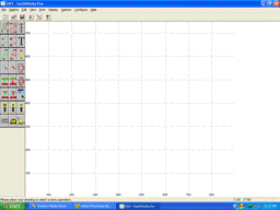
EarthWorks is easy to use:
Ø
User-friendly screen layout
Ø
Large icons for commonly used functions
Ø
Clear on-screen prompts guide you through each operation
Ø
Enter commands using the mouse, digitizer menu, or keyboard
Ø
Enter elevations using the keyboard, digitizer cursor or digitizer menu
Ø
Our VoiceVerification system speaks your commands
and elevation entries so that you can concentrate on your drawing and not on
the screen.
EarthWorks is easy to learn:
Ø
Embedded ShowMe! videos provide in-depth information on
ALL aspects of the software
Ø
Detailed on-line help system
Ø
Comprehensive full-color 222 page manual
Ø
On-line or on-site training classes
Ø
Highly trained, knowledgeable, and very patient tech support is only a
phone call away!
EarthWorks makes verifying your work and correcting errors
easy:
Ø
VoiceVerification speaks your commands and elevation
entries, making errors easy to catch "on-the-fly"
Ø
SmartMinMax automatically flags out-of-range elevations as they
are entered
Ø Our
"Display only out-of-range elevations" option shows only those elevations
that need correcting
Ø
Right-click editing allows you to change any information about any drawing
object
Ø
Elevation and cut/fill color map views make it easy to catch even subtle
mistakes
Ø
Color maps screens allow you to check ANY POINT in the drawing and see the
EXACT value calculated for the:
¬
Existing elevation
¬
Topsoil strip depth
¬
Over-excavation depth
¬
Proposed elevation
¬
Topsoil respread depth
¬
Subgrade depth
¬
Subgrade elevation
¬
Engineered fill depth
¬
Cut or fill depth
¬
Work area
EarthWorks is easy on your budget:
Ø
EarthWorks is affordable
Ø Leasing
plans are available
Ø Training
costs are low
Ø Support
is FREE for the standard version and nominal for the Pro version.
Ø Upgrades
are by annual subscription and are inexpensive and optional.

EarthWorks Features
EarthWorks can work with:
Ø Contour lines
Ø
Point-to-point lines
Ø Spot elevations
Ø Building pads
Ø Parking lot subgrades
Ø Demolition areas
Ø Basements
Ø Topsoil strip and re-spread areas
Ø Over-excavation under
parking lots and building pads
Ø Borings
Ø Rock layers
Ø Pipe trenches
Ø Rough staking
EarthWorks calculates your:
Ø Cut and fill
Ø Topsoil stripping and
re-spread
Ø Over-excavation and
engineered fill for your building pads and parking lots
Ø Strata cuts including
rock cut
Ø Parking lot and
building pad materials
Ø Pipe trench excavation
and materials
Ø Rough staking
Ø Sub-totals by area
Ø Areas, lengths, segment
lengths and counts
Enter site drawing information from:
Ø Single sheet drawings
Ø Overlaid drawings
Ø Multi-sheet drawings
with matchlines
Ø AutoCAD tm drawing
(Pro version only)
View, verify and print your results on:
Ø Comprehensive
multi-page job totals reports
Ø Existing elevations in
plan view or 3D
Ø Existing elevations
after demolition in plan view or 3D
Ø Over-excavated
elevations view in plan view or 3D
Ø Proposed elevations at
Finished Floor and Top-of-asphalt in view or 3D
Ø Proposed elevations at
subgrade in plan view or 3D
Ø Cut and fill volumes
text and graphic reports
Ø Cross-sections between
any two points
Ø Staking reports in text
and graphic formats
Ø Trench reports in text
and graphic formats
Hardware requirements:
Ø Windows computer
running Windows 95, 98, Me, NT 4.0, 2000 or XP
Ø Intel Pentium
processor, 500Mhz or faster
Ø Digitizer tablet with a
Wintab driver (GTCO digitizers recommended)
Ø Color printer
|